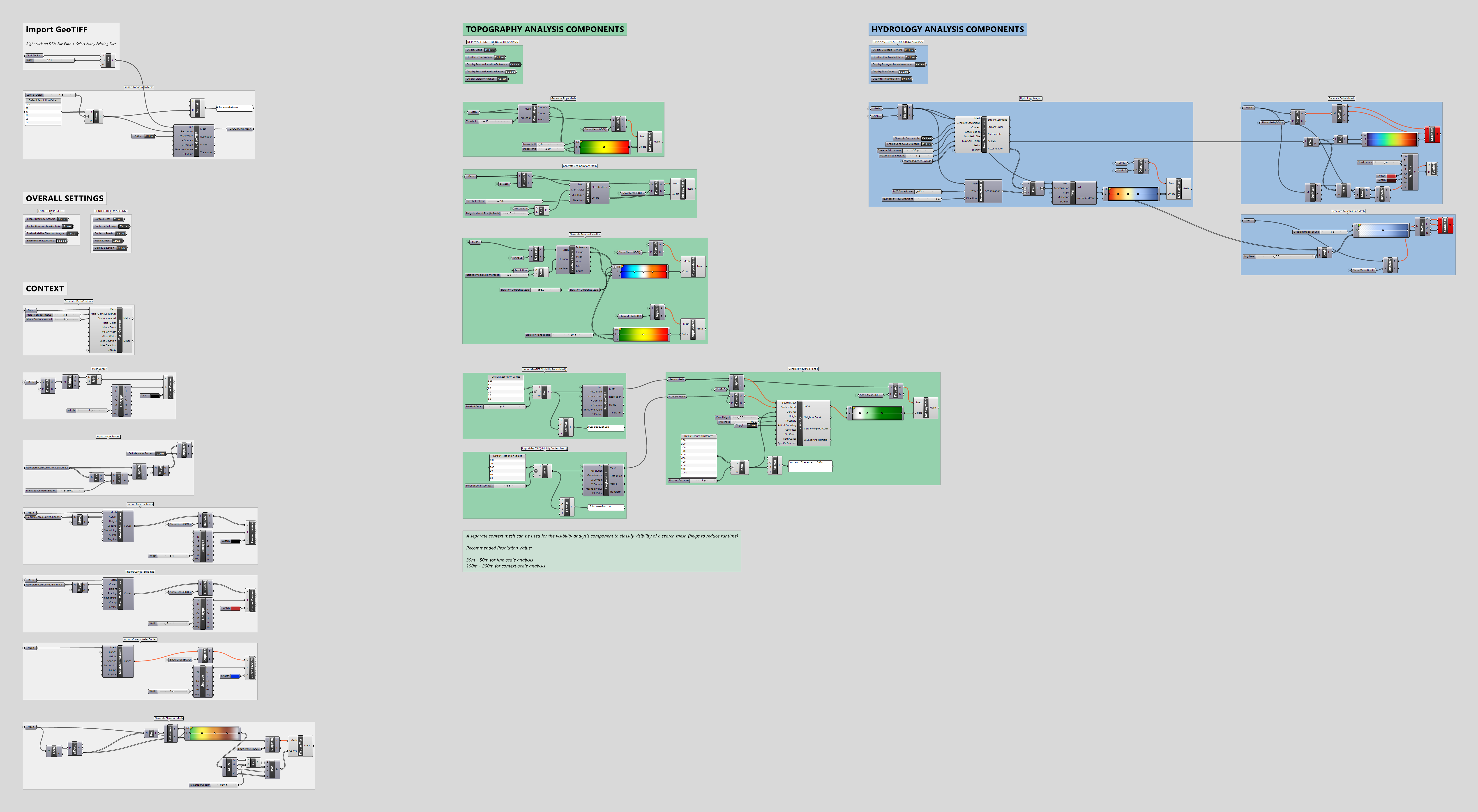
Topography Analysis Toolkit (Castor 1.2.4)
Example Grasshopper definition that provides a complete workflow for out-of-the-box, clear and informative topography analysis for any site, using only a projected GeoTIFF as input. Download file (ZIP) includes GH definition, Rhino model with buildings, roads, and water bodies, as well as 36 DEM tiles sourced from the National Map (USGS) of the Finger Lakes region in central New York, USA.