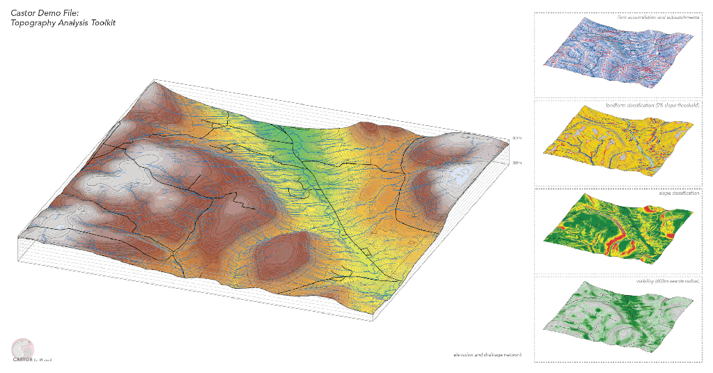
Topography Analysis Toolkit
Example file that provides a complete workflow for out-of-the-box, clear and informative topography analysis for any site, using only a GeoTIFF as input. File includes eight tiles sourced from the National Map (USGS) of the Finger Lakes region in central New York, USA.