Where Should We Build? [preview of Suitability Analysis Toolkit]
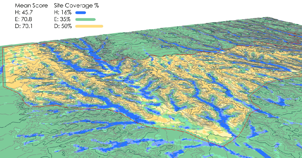
Nature-based design toolkit (in active development) that empowers effective planning decisions about preserving drainage corridors and green space where it is most likely to thrive, at the earliest stages of project conception and design. Suitability for development is calculated with a matrix of terrain characteristics that accounts for the flow of water at all scales, leaves room for nature throughout the design, and locates development strategically to minimize disruption of the landscape. The toolkit makes use of nearly every Castor component, plus additional scripts.
Urban Development Patterns [preview of Suitability Analysis Toolkit]
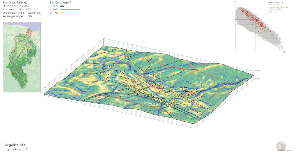
Nature-based design toolkit (in active development) comparing weighted suitability scores with the existing urban fabric, based on available open data for building footprints (Microsoft Open Buildings) and state roads. Models are used to calibrate the suitability scores across different terrain types within the same watershed (Genesee River, upstate New York). A general trend of buildings located on more-suitable cells is observed across the watershed, particularly in more topographically constrained regions with a higher average slope.
Initial Release of Castor [v1.0.4]
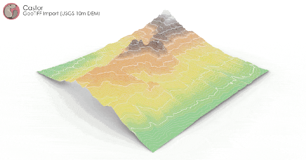
Showcases hydrology analysis features, including drainage networks, flow accumulation, and catchment delineation.
Development Log #1 [v1.0.6]
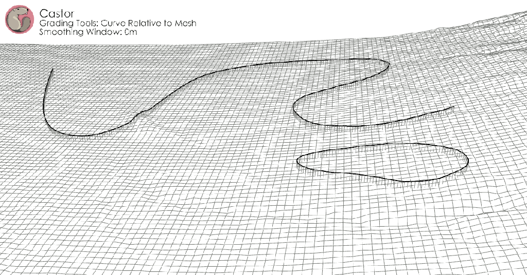
Showcases advanced grading features, including constrained curve relative to mesh. Examples include grading a path within 10% slope constraints and ensuring positive drainage throughout a channel network.
Development Log #2 [v1.0.8]
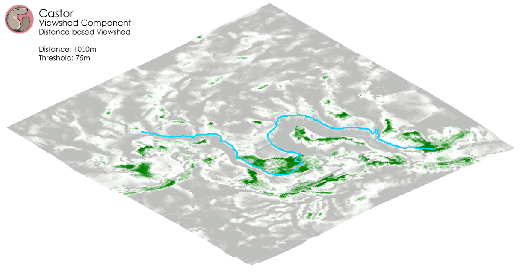
Showcases viewshed analysis tools, including viewshed from point and viewshed access map. Optionally, constrain viewshed access to specific feature curves.
